Games for Cities
Finding Places (2016)
Hamburg
Developed by:
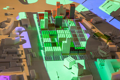
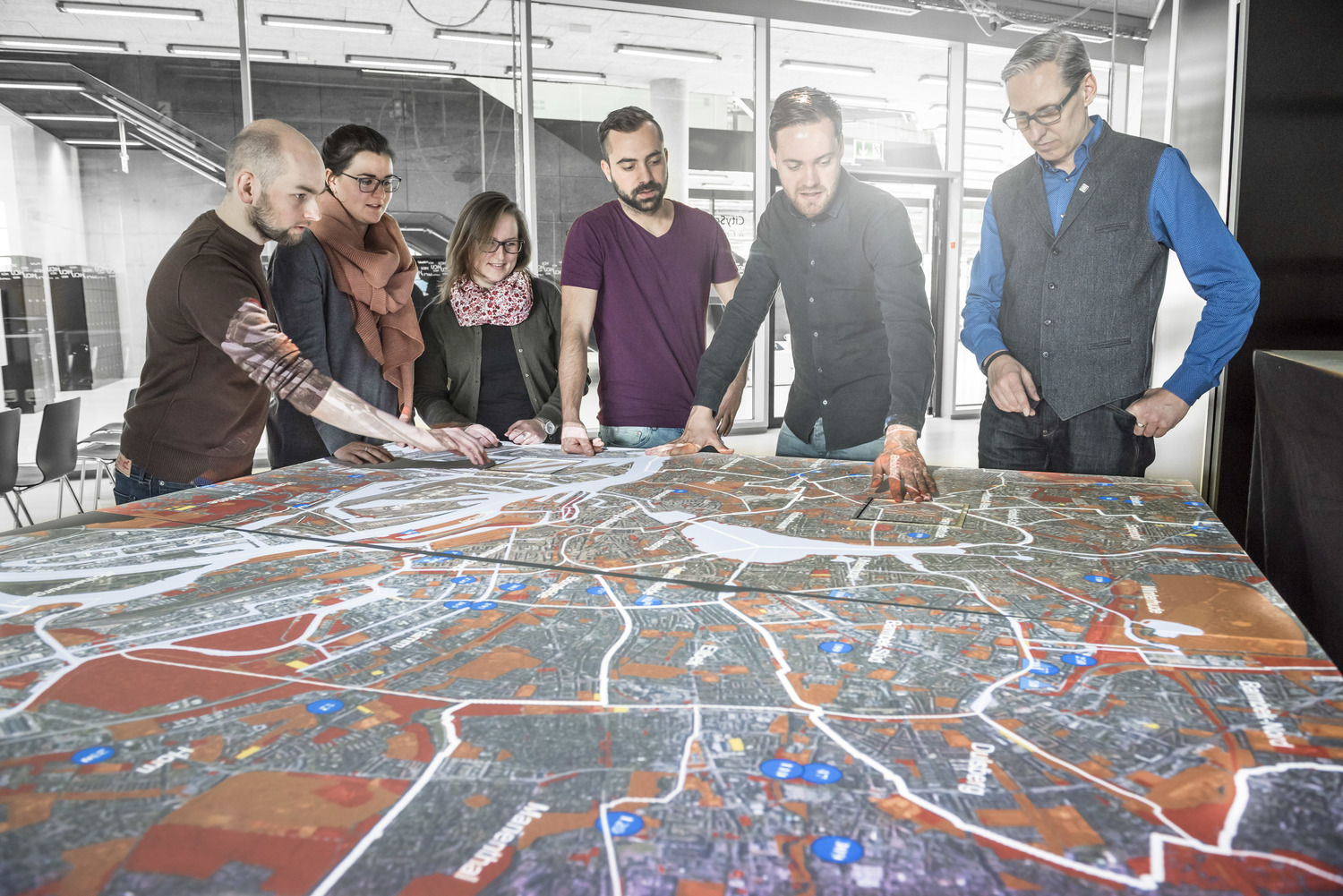
LEGO-tized 3D representations of existing urban areas in Hamburg providing an analog-digital interface that encourages non-expert stakeholder participation in rapidly prototyping urban interventions.
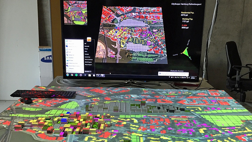
Finding Places is a collaborative project run by the CityScienceLab at Hafencity University and the city of Hamburg in partnership with M.I.T and their open-source program CityScope. It is a serious that game utilises Tangible-Interactive-Modelling (TIM) technology to find suitable spaces in Hamburg for constructing accommodation for a further 20,000 refugees. By using an array of optically tagged Lego objects, computer vision, and 3D projection mapping, GIS data is used to create ‘LEGO-tized’ 3D representations of parts of Hamburg-Rothenburgsort – currently a prospective urban development. The main question asked, how a decentralised accommodation of refugees can lead to successful integration?
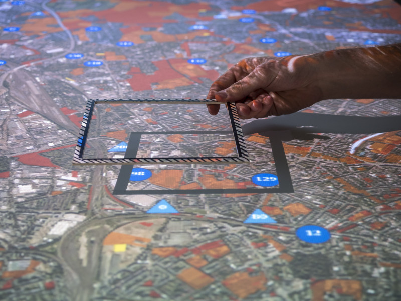
The tool enables rapid prototyping and testing of urban interventions, by running real-time simulations that demonstrate the impact of either adding, subtracting, or moving various urban services. This enables testing for things like: walkability (accessibility to open space or service amenities), locating a new office block in proximity to sufficient housing, adding a bus stop to a neighbourhood, or decreasing service delivery costs through reducing distances between sites of production and consumption. Each individual data variable can either be isolated for analysis, or be analysed in combination with any number of other variables. The tool demonstrates a new way for agencies to work together and model the relationship between different urban parameters such as land use, mobility, or sustainability, in real-time. Each parcel of land can be checked for feasibility.
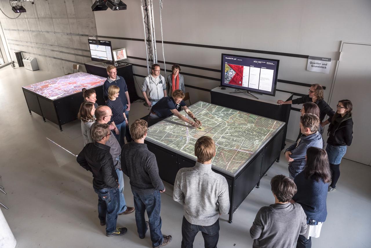
Using Lego enables anyone to participate in the building of models without being intimidated by complex algorithms and interfaces. This makes it a great tool for community engagement, but also for experts and professionals to collaborate on multidisciplinary urban problems with a common language. The city promises to examine the surfaces found on the actual suitability and publish the test result within 14 days. Configurations and data from the Hamburg model are uploaded to our cloud server and viewable from the web. Finding Places fosters dialogue and creates transparency for decision-making. This technology has proven to be a highly versatile tool that is able to address a wide range of urban issues, from pedestrian modelling in Singapore, to land use planning in Saudi Arabia, and last mile logistics in California.
 Photographer: Walter Schießwohl